Crawford Notch Photography
WRITTEN BY: BRUCE LOVELACE
PUBLISHED ON: October 2025
There are several notches through the White Mountains of New Hampshire and this post will give you a pictorial introduction to one of the most famous, Crawford Notch. This small collection of Crawford Notch photos is from a photo shoot one day in mid-October of 2025.
These notches that wind between the New Hampshire mountains serve as routes scenic highways, hiking trails, and also as locations for some great photos.
 Coliseum Falls Sign
I started my photography just a few miles north of the small town of Bartlett, New Hampshire at the Arethusa Trail.
If you're hiking in Crawford Notch State Park, don't just rush directly to the famous Arethusa Falls! Take a short detour from The Arethusa Trail onto the Bemis Brook Trail to discover the charming cascades of Coliseum Falls and Bemis Falls before continuing on to Arethusa.
 Crawford Notch Photo Opportunities Map
1. COLISEUM FALLS
The first photo I took during my visit to Crawford Notch was the short, but enchanting Coliseum Falls. Coliseum Falls has a total height of about 12 feet That includes of multiple cascades. The upper section is an 8–10 foot drop, while the middle section, which gives the falls its name, is a shorter 2–3 foot horseshoe-shaped cascade.

2. BEMIS BROOK FALLS
Bemis Falls is only about 8 feet tall, but has three distinct drops which makes it a great subject for a photograph.

Although the water flow in the brook was quite tame I still managed to get a few keepers. In the photo below I "tested" the power of technology of my Canon R6 Mark II and its advanced image stabilization (IS).
Getting the creamy blurred effect of the cascading water while maintaining the sharpens in the rest of the image used to be impossible without using a tripod. I used the IS with a 0.5 second exposure and got the results I wanted.
Now it's achievable to shoot longer exposures using only hand held only support for the camera rather than using a tripod.
 Lower Bemis Falls, Crawford Notch, NH
Slow shutter speed of 1/2 second to blur the water
3. ARETHUSA FALLS
After the Coliseum Falls and Bemis Brook Falls, discover the gem of the hike, Arethusa Falls in New Hampshire's White Mountains! Earlier in the day would have been better timing for the best lighting for the photo below, but I was able to even out the exposure with Photoshop.
 Arethusa Waterfalls, Crawford Notch, New Hampshire
Arethusa Falls is approximately 150 feet tall, with many people claiming that it's New Hampshire's tallest single-drop waterfall. The falls are fed by Bemis Brook.
4. Willey POND, Crawford Notch
Just 3.5 miles north of the Arethusa Trail and its 3 photogenic waterfalls is Willey House and Willey Pond. It's not a huge area, but still has plenty of opportunities to take some good photos. The mountains and the pond combination make for plenty of opportunities for good photography.
I photographed the sign for Willey House twice, about 1 hour apart. I liked the cloud formations in this one better.
 Willey House Historical Site
The photo of Willey Pond below was taken from the bridge that crosses the water on the south end of the pond. If you're lucky with the timing of your visit, this location is perfect for shooting a reflection photography of the nearby mountains in the pond.
 Willey Pond View From Bridge
I liked the composition below a little more than the one above. This was taken at the beginning of the Willey Pond Loop Trail, a 1/4 mile flat loop on the east side of the pond. This angle puts less emphasis on the water and more visual immpact from the mountains.
 View From Willey Pond Loop Trail
I zoomed my lens in with view #2 below, from slightly farther along on the Willey Pond Loop Trail to eliminate the sky. I like the four layers of foreground, water, trees, and base of the mountain with a single splotch of red to add a little more visual interest.
 Willey Pond Loop Trail-View-2
5. SAM WILLEY TRAIL
 Sam Willey Trail Map
Another easy path to take from Willey Pond is the Sam Willey Trail. Just cross over the pedestrian bridge and slant to the right. It loosely follows the Saco River and has no significant elevation gains or losses.
I took the photo below from that path.
From this view you have no idea that the Saco River winds its way on the other side of these grasses.
Again I was intrigued by the four different layers in the scene that was presented in front of me. Starting with the shaded grass, the sun-drenched grass, the mountains and ending with the blue sky.
 Sam Willey Trail View
Thanks for coming along on my visual journey of the Crawford Notch area in the White Mountains of New Hampshire. I've been blessed to have snow skied in the area for over 30 years, but never visited the notch and Kancamagus highway in the Fall.

Bruce Lovelace is the publisher of TravelingPhotographer.com. Bruce shot portraits full time for over 35 years. Now he shoots more travel photography. Read more about him on the About Page. He also publishes how to articles and camera gear reviews at the Photography Tips and Canon Geek websites.
The Traveling Photographer Location on Google My Business
You might like these
Diana's Baths Photos-Capture the Magic of Diana's Baths New Hampshire
Frozen in Time: The Beauty of Diana's Baths. Photographic Journey into the heart of New Hampshire's White Mountains. Cascading waters meet granite bedrock.
New Hampshire Travel Photos Taken By Photographer Bruce Lovelace
The images from The Traveling Photographer's excursions posted to "New Hampshire Travel Photos" show two contrasting experiences.
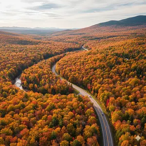
Photographer's Guide To Kancamagus Highway In The White Mountains
Join the Traveling Photographer on a magical photographic tour. See the image gallery. Photographer's Guide To Kancamagus Highway in New Hampshire


© 1993-2026 All images and content are copyrighted
The Traveling Photographer - 124 Magnolia Ave. Pitman NJ 08071